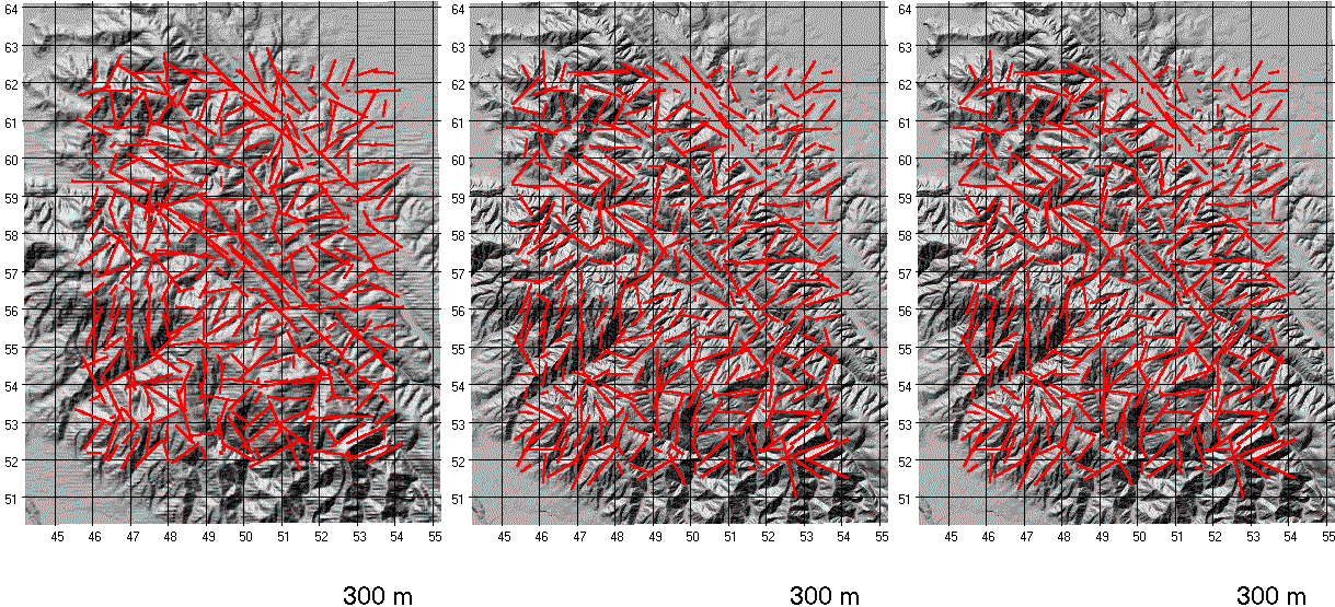
Montara Mountain, California, Fabric Sensitivity to DEM
Animations of the topographic fabric computed with variously sized windows for three independent 1:24,000 DEMs of the Montara Mountain, California, quadrangle. From left to right the DEMs are a 30 m level 1 DEM (note the horizontal pattern, an artifact of the digitization process present in some level 1 DEMs), a 30 m level 2 DEM, and a 10 m level 2 DEM The scale of this map does not do justice to the increased resolution of the 10 m DEM.
Fabric intensity and orientation are computed and displayed every 500 m. To avoid edge effects, only the central portion of the DEM was used and all region sizes have the same number of computed points.
The three images are synchronized, so that the same frame shows the same region size in all three DEMs.
Figure 11 shows a blowup of part of this map, with the fabrics from the three DEM superimposed on a single map.