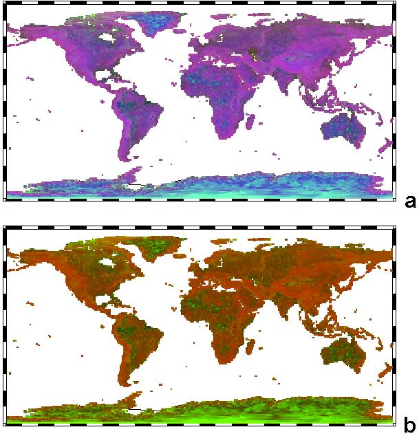
Global Terrain Classification
Both maps use the GTOPO30 data set, with 1° regions.
a is a three parameter classification using
organization, ln(S2/S3), to control the green color
natural logarithm of elevation to control the blue color
b is a two parameter classification using
steepness, an inverted ln(S1/S2), to control the red color,
organization, ln(S2/S3), to control the green color.
Note that in both classifications, the continental ice sheets in Greenland and Antarctica appear different from any other locations on earth. Both area show low steepness, strong organization, and high elevations, which controls their distinctive colors. In contrast the Himalayas show strong steepness, low organization, and high elevations, characteristic of many of the mountain ranges.