GEOG3150 Semester 2
Lecture 7
Agent-Based Modelling
& Geography
Dr Nick Malleson
Dr Alison Heppenstall
Click here for full screen
How to use these slides
These slides are made using HTML, so they need to be read on-line. You can use the arrows in the bottom-right corner to move between slides, or press the right/left arrows on your keyboard. Pressing escape gives an overview of all slides.
There are also notes for some of the slides. To see these, either print out
the slides (instructions below) or press the 's' key. This
puts you into a different mode that will show notes alongside slides.
If you would like to print them out for offline reading, or save them
as a pdf, you need to add '?print-pdf' to the end of the URL, like so:
http://www.geog.leeds.ac.uk/courses/level3/geog3150/lectures/lecture7/lecture7.html?print-pdf
Then you can print as normal (e.g. File -> Print). Depending on the version of your browser, you might also need to select'landscape' paper type..
Important: printing only works using Google Chrome
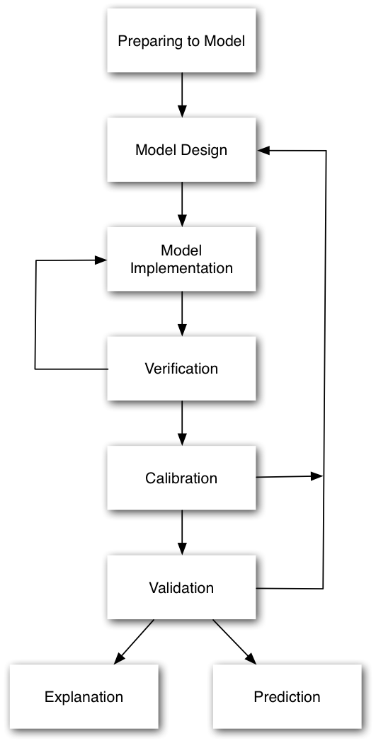
Recap: The Model Building Process
Preparation: Literature review
what do we know about fully?
what do we know about in sufficient detail?
what don't we know about? (and does this matter?)
What can be simplified?
Preparation: Data review
Outline the key elements of the system, and compare this with the data you need.
What data do you need?
What can you do without?
What can't you do without?
Designing and building the model
ODD (Overview, Design concepts, Details)
KISS / KIDS
Recap: The Model Building Process
Verification
Does the implementation match the design?
Are there any bugs?
Calibration
Adjusting parameters to fit real-world data
Validation
Testing the model on new data.
Prediction / Explanation
Outline: ABM and Geography
Reasons to model
1. Exploring theory (explanatory models)
Implement the theoretical understanding of behaviour
Can explore the dynamics that play out
Test the effects of different theories
Model/results are unencumbered by geographical complexity (e.g. Elffers and van Baal, 2008)
Easy to understand what the mode is doing
Reasons to model
2. Real-world predictions (predictive models)
Models with abstract environments a great in some situations
But what about making real-world predictions?
In some cases the underlying geography is a fundamental part of the model and abstracting space is not appropriate
E.g., "what affect will this road closure have on burglary rates in Headingley?"
Example: Exploring crime theory
Birks et al. (2012)
Randomly generated abstract environments
Theoretical 'switches'
Rational choice perspective
Routine activity theory
Geometric theory of crime
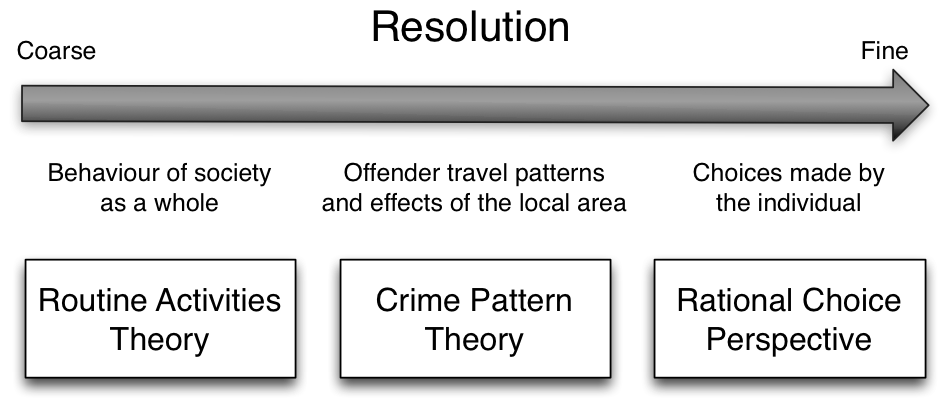
Compare results to expected outcomes:
Spatial crime concentration
Repeat victimisation
Journey to crime curve
Example: Exploring crime theory
| Theory | Enabled | Disabled |
|---|---|---|
| Routine activities | Agents assigned a 'home' and routine paths | Random movements |
| Rational choice | Victim attractiveness (based on risk, reward, effort) | Homogeneous target attractiveness |
| Awareness space | Dynamic awareness - alters offender decision-making | Uniform environment awareness |
Results:
All hypotheses are supported
Rational choice has lower influence
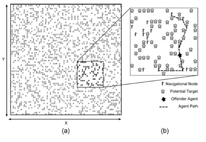
Example: Real crime patterns
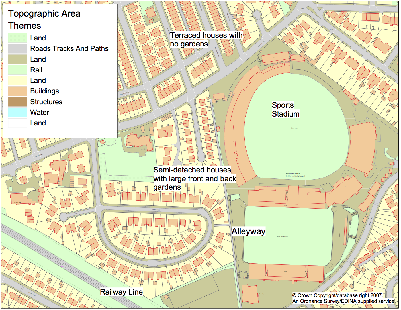
This model uses a more realistic geography (part of East Leeds)
Buildings / houses
Roads
Alleyways
Railway lines
etc.
Able to explore the impacts that changes to the environment or changes in behaviour have on crime in a real area
Space and place.
The choice of model type (explanatory or predictive) is similar to space & place arguments in geography.
Space
Abstract
Blank canvas, a container, impersonal
A geographic space that is completely homogeneous
Place
Experienced, personal, layered
Has meaning imposed by personal experience or some collective significance (e.g. landmarks).
Heterogeneous
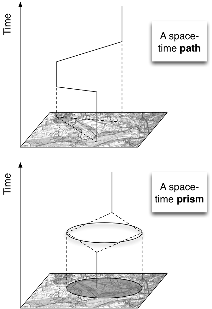
Time Geography
Explore fundamental geographical theories with agent-based models
Envisaged before we had imagined the possibilities that computers could offer.
Time Geography (Hägerstrand, 1970) is a great example.
A conceptual framework for understanding human spatial behaviour
Examine how movements are constrained by space and time
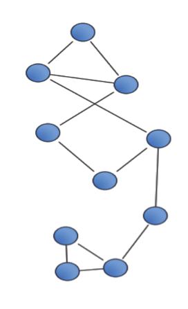
Space-Time Path
Traces the movement of an individual through space and time.
Space-Time Prism
Ability to reach locations in space and time, under constraints of fixed activity points
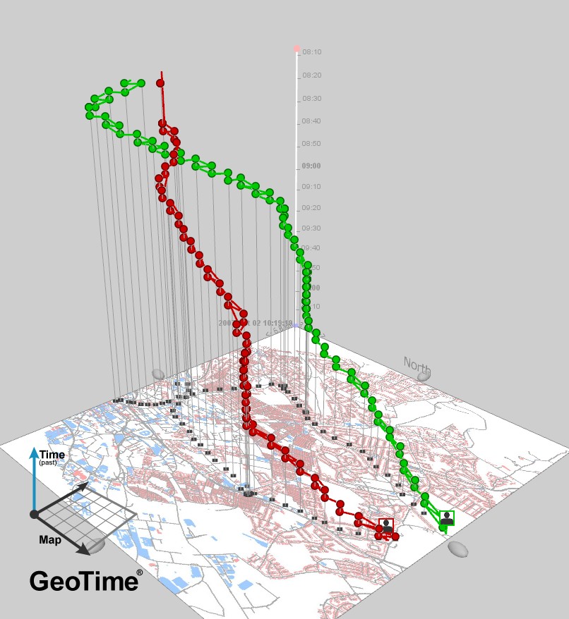
This is an example from Nick's thesis. It shows the movements in space and time of two agents.
Environment Quiz
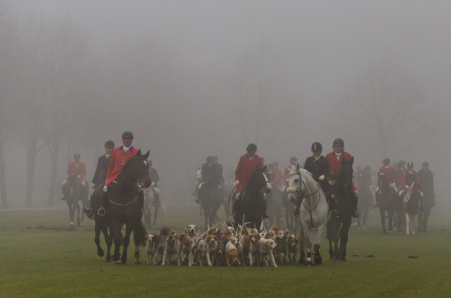
You want to create a model to better understand fox hunting by simulating a hunt in progress (riders, hounds, foxes). The aim is to find out how many foxes are needed for an enjoyable killing spree, and where they should be located.
List some elements that you would want to include in a virtual environment for this model.
Would you use an abstract or a more realistic environment?
Outline: ABM and Geography
Different types of geography: Abstract Grids
Objects located at discrete (integer) coordinates
Can only move onto cells
Similar to raster GIS data model
Often conduct neighbourhood / proximity queries
Which cells are next to me?
Different types of geography: Continuous space

Objects located at arbitrary decimal coordinates
Can move to any location within the boundary of the world
Often the researcher restricts these movements to roads, paths, etc.
Conduct spatial queries
Find all objects within 10 meters
Find objects that are within a boundary
Continuous space example
Boundaries of the world
What happens if an agent tries to walk outside the boundary of the world?
Agents bounce back from the boundary (bouncy?)
Walls absorb agent momentum (absorbent?)
Left/right and up/down borders joined together (torus)
Choice of boundaries depends on the application area
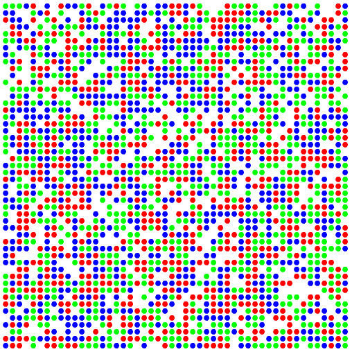
Torus example
Boundaries Quiz
Can you think of some example applications that require the different types of boundary.
Bouncy:
Absorbent:
Torus:
Different types of geography(?): A-Spatial
So far, we have come across grid and continuous space environments.
In some models, a geographical environment is not needed.
E.g. a social network
Can still account for interactions, complexity, emergence, non-linearity, etc. etc.
Can you think of a scenario where an a-spatial agent-based model would be appropriate?
Outline: ABM and Geography
Realistic geographic environments
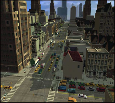
Unsurprisingly, agent-based models in geography often attempt to include a realistic representation of physical space
Often essential for explanatory models (although not always).
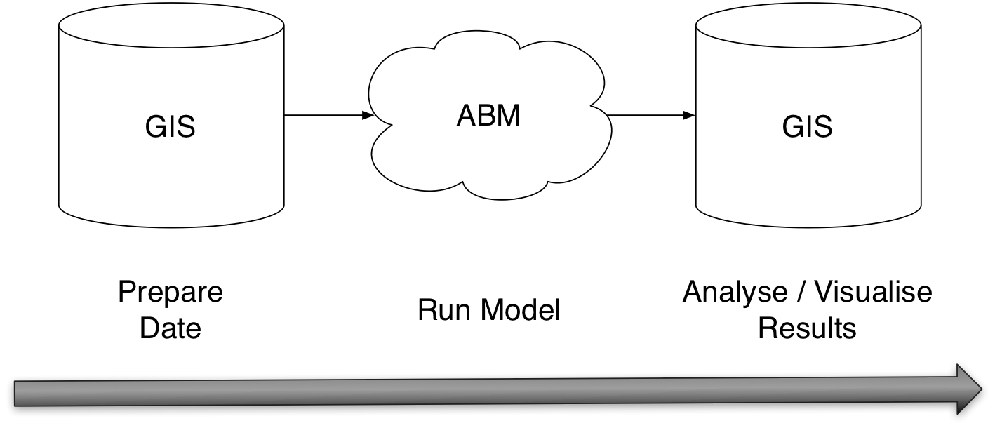
Hence some mechanism is needed to incorporate spatial data into a model
Common solution: GIS + ABM
Issues with combining ABM & GIS: Time
GIS are inherently static
GIS data model represents a single point in time
Some work into a temporal GIS data model, but no widespread solutions
But time essential in an ABM
Need to link GIS and ABM
Two approaches: loose vs tight/close coupling
Loose coupling
Loose coupling
Have you loosely coupled a GIS and a model in other work?
Maybe in your semester 1 projects?
Loose Coupling Example
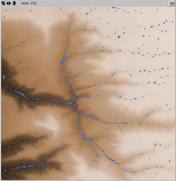
Wilensky, U. (2006). NetLogo Grand Canyon model. http://ccl.northwestern.edu/netlogo/models/GrandCanyon Center for Connected Learning and Computer-Based Modeling, Northwestern University, Evanston, IL.
Tight coupling
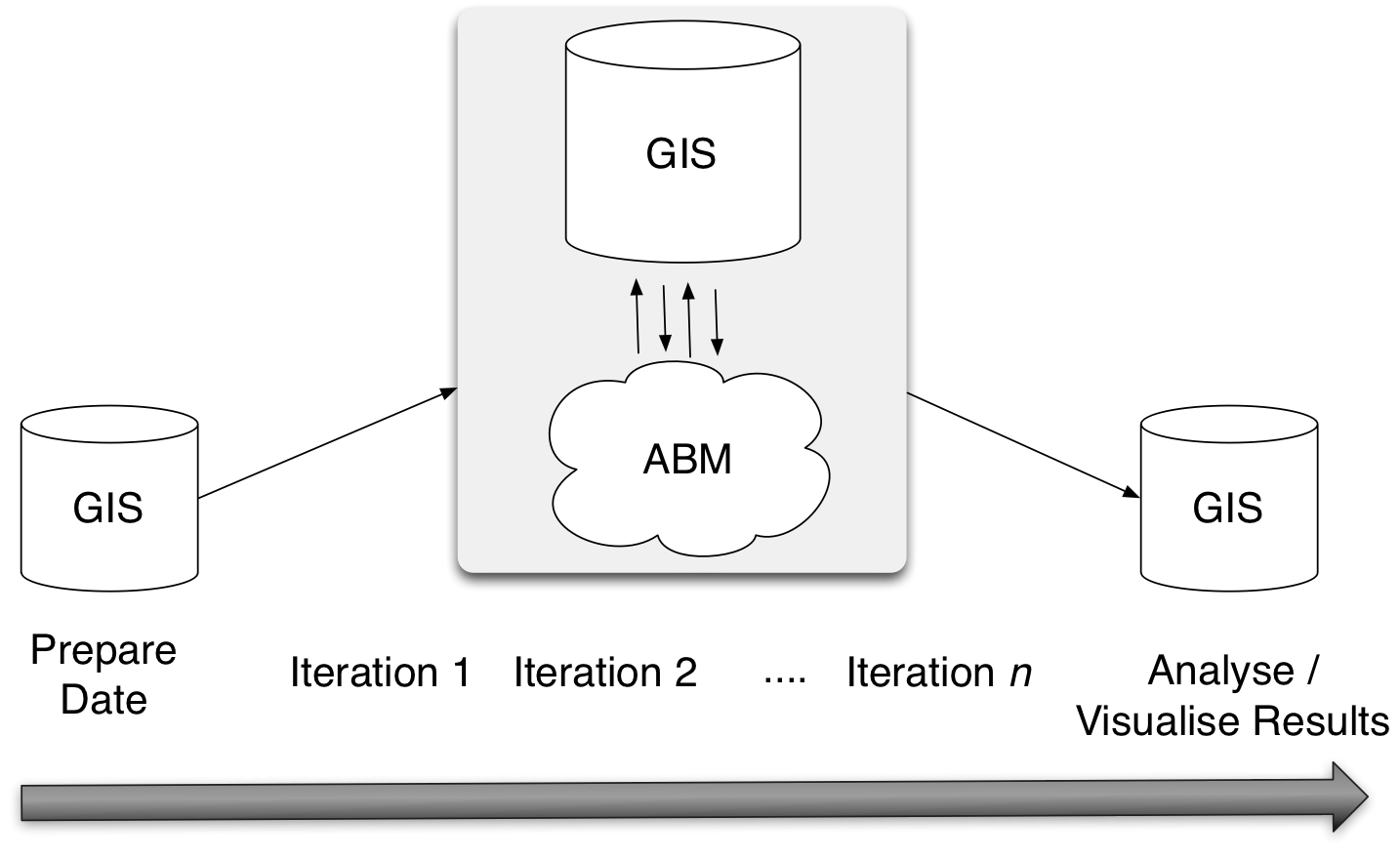
Tight coupling example: Agent Analyst
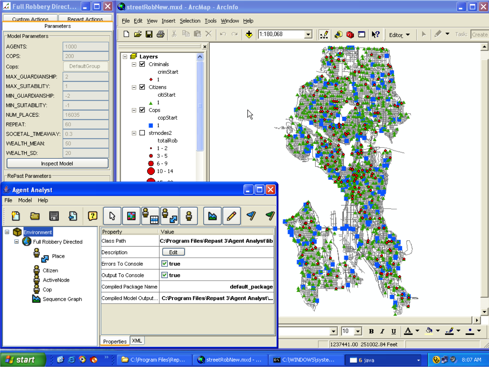
Groff, E. R. (2006). Exploring the Geography of Routine Activity Theory: A Spatio-temporal Test Using Street Robbery. Unpublished Dissertation, University of Maryland, College Park, MD.
Agent-based model of street robbery
Uses the 'Agent Analysis' ArcGIS plugin.
Shows the initial start locations of the three types of agents
Criminals (i.e., citizens with criminal propensity)
Citizens (i.e., citizens without criminal propensity)
Cops (that's American for 'Police').
Groff, E. R. (2006). Exploring the Geography of Routine Activity Theory: A Spatio-temporal Test Using Street Robbery. Unpublished Dissertation, University of Maryland, College Park, MD.
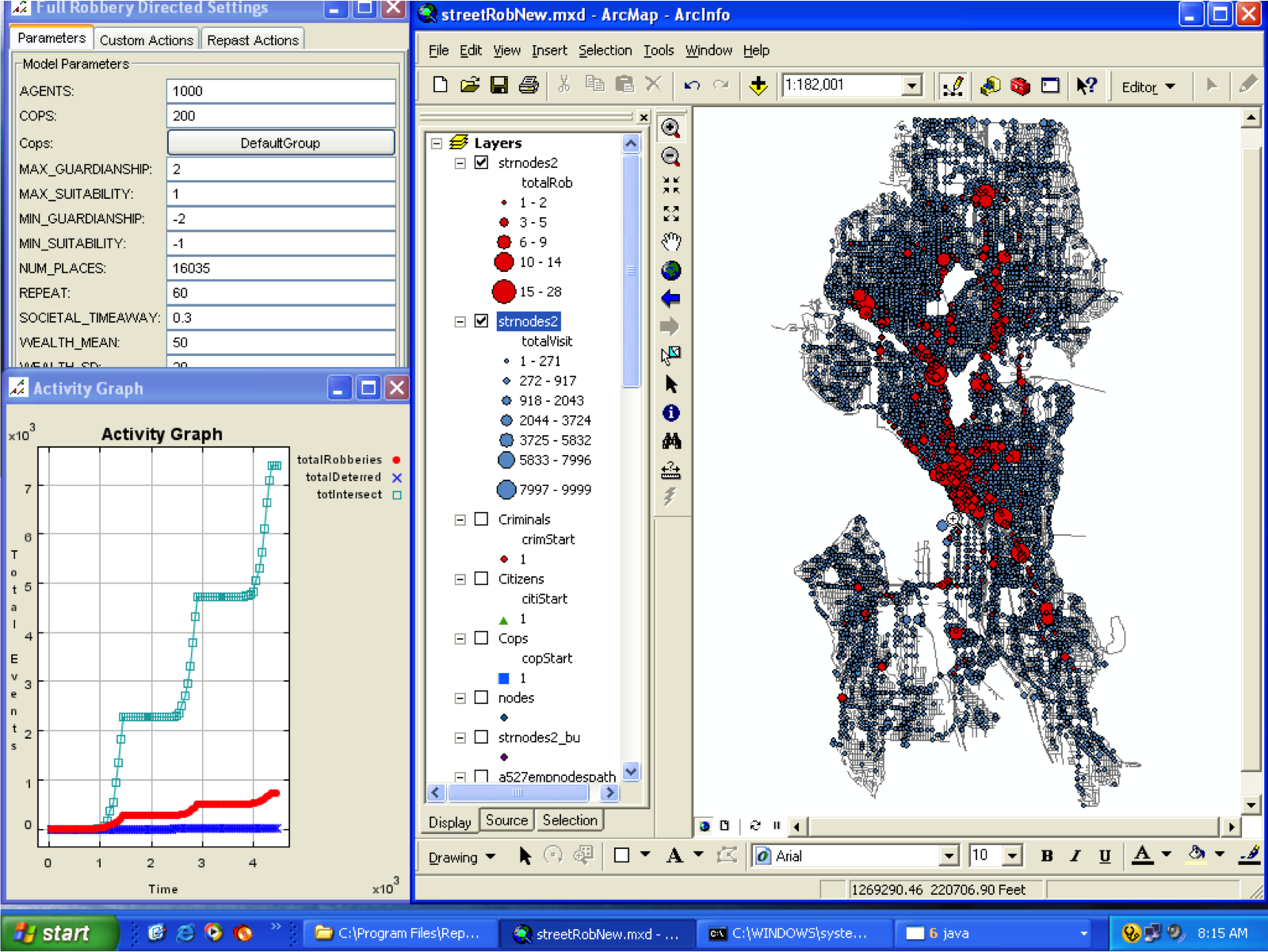
Agent Analyst
Pattern after three days for street robbery.
Map updated dynamically as the model runs
Upper left: parameters window
(This wasn't used, all changes coded into the model directly
Lower left: graph of three of the variables in the model:
totalRobberies - the total number of robberies at an intersection
totalDeterred - the number of times the presence of a police officer stopped an offender from deciding to commit a robbery
totIntersect - the number of times more than one citizen agent was at a node at the same time so that a crime might occur.
Loose vs. Tight coupling
Loose
Efficient: GIS are slow, allowing the model to run on its own will almost certainly be quicker
Flexible: The model can run on any computer system, including high-performance 'grid' systems
Free: The model is not tied to a proprietary GIS so can be released and reused freely by others. (Note: Open-source GIS systems are available, e.g. QuantumGIS and GRASS)
Tight
Convenient: Easy to see what the model is doing while it is running
Interactive: Possible to interact with the model and influence an individual model run.
Reusable: Stakeholders / users will find it easier to use if it is built into their GIS.
Summary: ABM and Geography
References
Elffers, H. and van Baal, P. (2008). Realistic spatial backcloth is not that important in agent based simulation: An illustration from simulating perceptual deterrence. In Liu, L. and Eck, J., editors, Artificial Crime Analysis Systems: Using Computer Simulations and Geographic Information Systems, chapter 2, pages 19-34. IGI Global.
Birks, Daniel, Michael Townsley, and Anna Stewart. Generative Explanations of Crime: Using Simulation to Test Criminological Theory. Criminology 50, no. 1 (2012): 221-254.
Miller, H. J. (2005) A measurement theory for time geography. Geographical Analysis 37(11): 17-45.
Hägerstrand, T. (1970) What about people in regional science? Papers of the Regional Science Association 24(1): 6-21.
Groff, E. R. (2006). Exploring the Geography of Routine Activity Theory: A Spatio-temporal Test Using Street Robbery. Unpublished Dissertation, University of Maryland, College Park, MD.