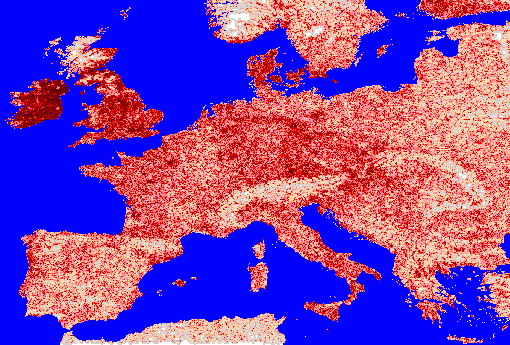
Main and minor road network density
Description
Using ArcInfo a fine 0.1 DM grid with a value of 1 for cells which contained main or minor road sections (selections from the communications network) and a value of 0 otherwise was created. This grid was aggregated into 1, 2, 3, 5, 7, 11, 13 DM resolution grids with the values in each cell being the sum of cells values in the fine grid. ArcView was then used to split the higher level aggregations into the 1DM resolution so that all the grids contained the same number of cells. The aggregations were then weighted and summed together to produce the final input data values mapped above.Source=Bartholomew data
Comments
- This map is very similar to the communications network density map since a large part of the communications network is major and minor roads.
- The density of major and minor roads is very high in Ireland.