
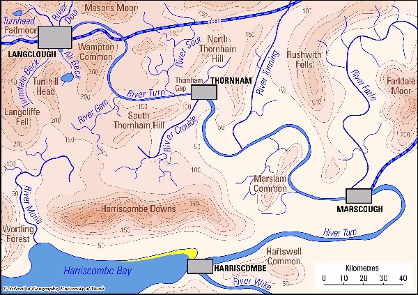
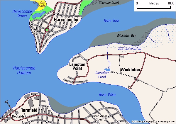
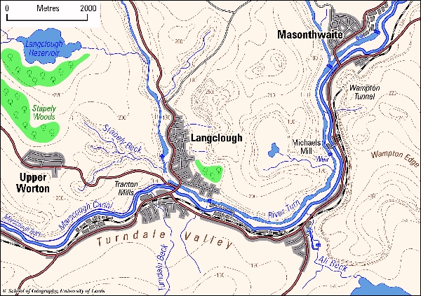
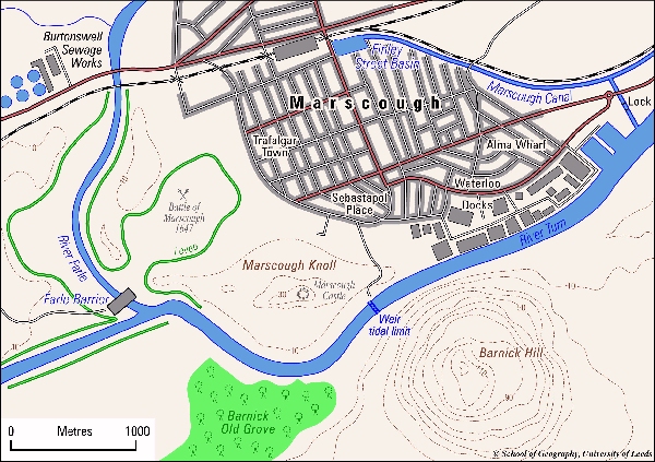
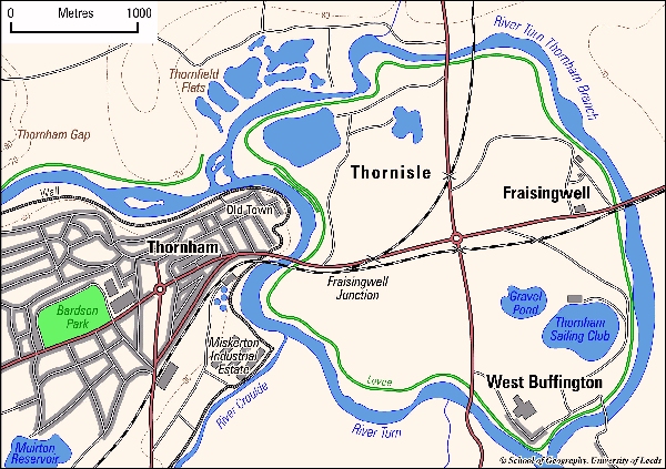
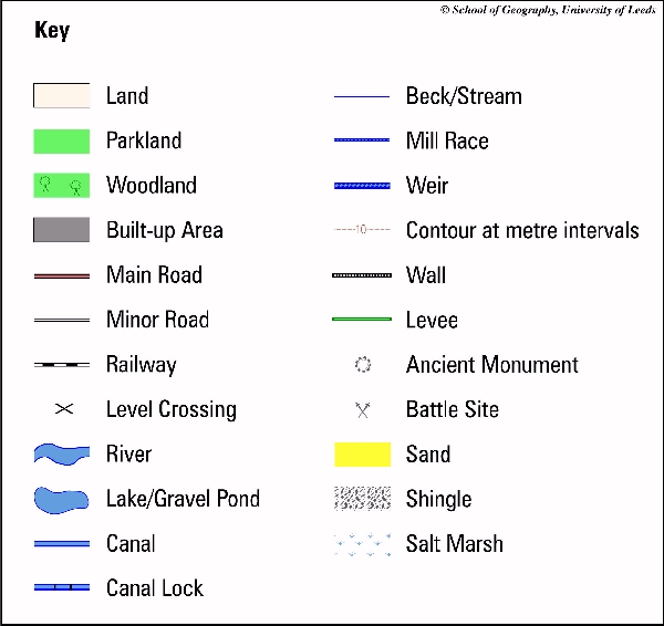
The case is based on a hypothetical catchment - The River Turn, which is similar in size to the River Ouse. Students are asked to work in groups to design an integrated flood warning system for the whole catchment.
There is a full catchment map and enlarged map for four towns. The pack contains information about flood warning systems and about the history, geography and flooding history of the River Turn. Students must consider what instrumentation is required - river flow gauges, boreholes, raingauges and radar, the need for telemetry and the cost and appropriateness of different flood warning methods. Issues include warning ethnic minorities, temporary residents like students and isolated rural properties.
Suitable for students taking: Geography; Hydrology; Environmental Science at Levels from Undergraduate year 2 to Masters. It has been used with groups of 5-7 in a class of 100.
Duration of Case: Presented as Part of GEOG2400 Urban Hydrology, students had three weeks to complete their reports. The case material notes were augmented by lectures in the module. Students had completed the Flood Warning Strategy Case in the preceding two weeks which was excellent preparation. In a masters course two weeks would be plenty, or it could be done over three days in a more concentrated format.
Download:
RTurnStudentsnotes99.doc and
RTTutornotes.doc
River Turn Students Notes 06 and
River Turn Tutor Notes 06
Maps