
Here you will find links to some interesting NetLogo models that are relevant to the course. The models library page has many more examples. All are well documented and you can run them directly in your web browser.
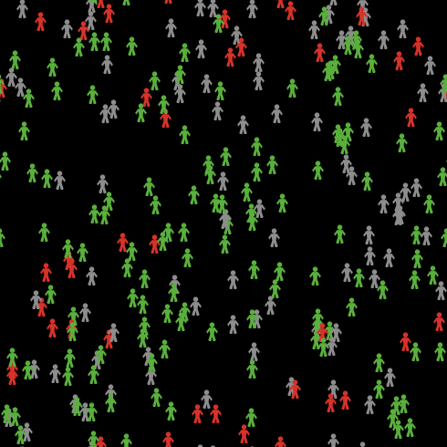
Thomas Schelling's model of residential segregation is one of the earliest (the first?) examples of an agent-based model. Unable to access the computing resources that we take for granted today, Schelling's original experimented involved tossing a coin and moving pieces around a board. The model consists of a 2D environment (early experiments were actually 1D!) populated by households that belong to one of two types of racial group. A parameter dictates the percentage of the same group that each household wants to live next to. Households are able to move to empty squares if they are unsatisfied (i.e. they live near to too many of the opposite type).
The novel research finding was that, even with a relatively low preference for the same racial type, the environment can become highly segregated. This is particularly interesting because segregation emerges even though no individual has a strong preference for segregation. Potentially this provides an insight into the dynamics of human residential segregation.
Information about the model is here. To run the model in your browser, use this link.
More reading

This model simulates the spread of the human immunodeficiency virus (HIV), via sexual transmission, through a small isolated human population. Parameters allow the user to experiment with rates of condom use, HIV tests and types of relationships.
Although this type of model is very abstract (it doesn't really come close to representing the world in any detail) it might be useful for really understanding the underlying dynamics of HIV transmission. For example, a researcher could try to determine whether it was better to promote safe sex or provide relationship advice/education. What other elements do you think the model needs to make it more realistic and/or more useful?
Information about the model is here. To run the model in your browser, use this link.
This model of disease spread includes parameters to represent the important characteristics that biologists have found to influence how a disease spreads through a population. These include population density and turnover, degree of immunity, ease of spread and duration of infection.
Information about the model is here. To run the model in your browser, use this link.
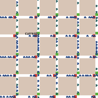
Traffic problems lend themselves nicely to Geocomputation methods. Each driver is an individual person with their own characteristics and behaviour, so creating a model to represent these individuals directly (like an agent-based model) is a very natural way to describe the system.
The Traffic Grid model allows the researcher to manipulate variables that control the speed limit, number of cars and traffic lights.
Information about the model is here. To run the model in your browser, use this link.
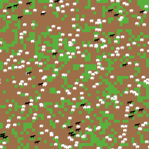
This model explores the stability of predator-prey ecosystems. It contains two types of agents: wolves and sheep. Wolves must eat sheep to survive and sheep need to eat grass. By varying parameters that control birth rates and the energy gains from eating, it is possible to find the points at which the system becomes unstable and one or both of the species die out.
Information about the model is here. To run the model in your browser, use this link.

In this course we will concentrate mostly on social science applications, but Geocomputation methods can be used to investifate a very broad range of different phenomena. The climate change model is an excellent example of this. Here, rather than represenging 'people', agents are used to represent things like carbon dioxide molecules, rays of sunlight and heat energy in the ground.
Information about the model is here. To run the model in your browser, use this link.
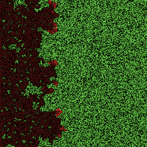
Another example of a model of the physical environment, this program simulates the spread of a forest fire. The researcher is able to vary the tree density which has in impact on how far the fire spreads. What other features could you add to this model?
Information about the model is here. To run the model in your browser, use this link.