Arc Toolbar
Having got "Hello World" working, we'll now add some functionality.
First off, download this set of Shapefiles (properly georeferenced with any luck!), and stick them in a map.
Now, in Arc, make yourself a toolbox (or reuse last practical's) and build the following model in modelbuilder.
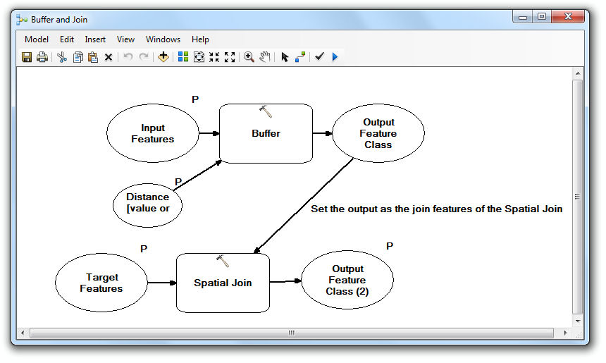
Double-click on the Spatial Join box, and make sure its Join Operation is set to JOIN_ONE_TO_ONE.
The model will be used to buffer around our houses, and then join the buffers with each house to make a new layer of houses. Most notably, there will be one house in the new layer produced for each house in the original dataset, and each house will have a Join_Count column value that tells us how many buffers it joined with. Run through the model once by hand, and then get it working as we did last practical, from the Risk calculation button. You'll need the Burglaries layer as the Input Features, 80 as the distance, and Buildings as the Target Features. Pay close attention to the values in the model inputs (are they a whole filepath, or just a name?) and their order in the model version.
Once you've got that working, go on to Part Three where we'll sort and list our buildings.